v0.1.0 / Aplikasi Desktop
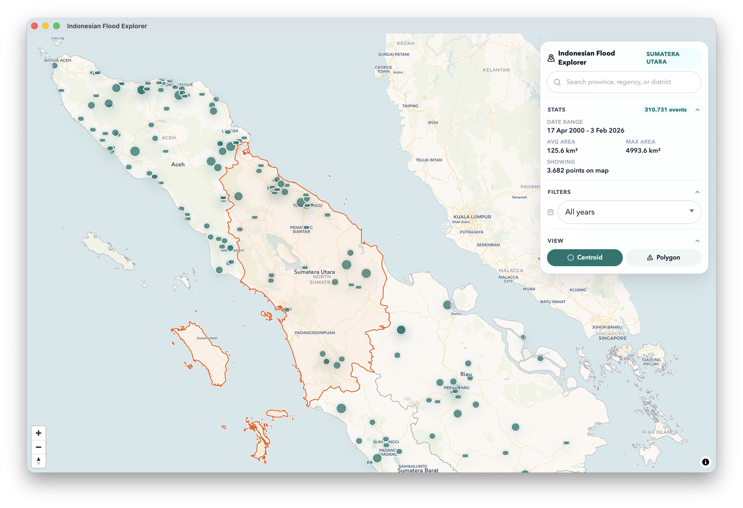
Jelajahi, filter, dan analisis 310.000+ kejadian banjir historis di seluruh Indonesia. Bisa offline. Didukung DuckDB dan MapLibre.
165 MB · unsigned · klik kanan → buka saat pertama kali
Fitur Utama
01
Data banjir tersimpan dalam file Parquet, diproses dengan DuckDB embedded. Tidak perlu internet untuk analisis utama.
02
MapLibre GL JS dengan CartoDB Voyager (online) dan Protomaps PMTiles (offline) untuk rendering peta penuh tanpa koneksi.
03
Cari provinsi atau kabupaten, filter berdasarkan tahun, dan dapatkan statistik real-time tentang kejadian, luas area, dan rentang waktu.
Mode Visualisasi
Kejadian banjir ditampilkan sebagai titik marker. Ukuran sesuai luas area. Hingga 1.200 marker sekaligus dengan ukuran yang dapat disesuaikan.
Batas wilayah banjir sesungguhnya ditampilkan sebagai bentuk polygon. Dimuat secara lazy. Menunjukkan luas sebenarnya dalam km².
Sumber Peta
Otomatis
Mulai offline, otomatis beralih ke peta online saat terkoneksi internet.
Online
CartoDB Voyager @2x raster tiles dengan detail penuh.
Offline
39 MB PMTiles. Cakupan seluruh Indonesia, zoom 0–10.
Teknologi
Mulai analisis kejadian banjir di seluruh Indonesia. 310.000+ kejadian, sepenuhnya offline, tanpa perlu akun.
165 MB · aarch64 · unsigned